


Canal de Charleroi

jp2remy
User
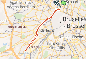

Length
12.5 km

Max alt
36 m

Uphill gradient
92 m
Km-Effort
13.7 km

Min alt
15 m

Downhill gradient
92 m
Boucle
Yes
Creation date :
2020-12-02 20:18:24.132
Updated on :
2020-12-02 21:01:09.281
2h01
Difficulty : Medium

FREE GPS app for hiking
 SityTrail
IGN / Geographical institutes
SityTrail Plus
The world is yours!
About
Trail Walking of 12.5 km to be discovered at Brussels-Capital, Unknown, City of Brussels. This trail is proposed by jp2remy.
Description
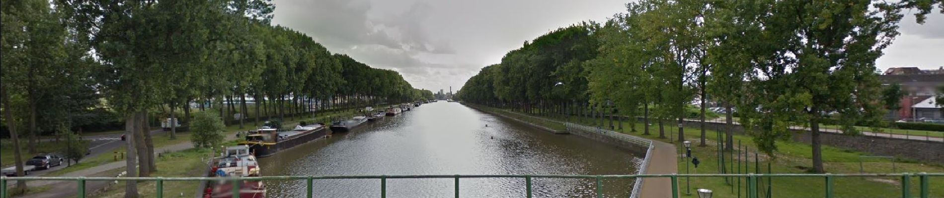
Promenade le long du canal entre le Boulevard Léopold II et l'écluse d'Anderlecht
Photos

Positioning
Country:
Belgium
Region :
Brussels-Capital
Department/Province :
Unknown
Municipality :
City of Brussels
Location:
Brussels
Start:(Dec)
Start:(UTM)
595114 ; 5635079 (31U) N.
Comments